The Arches
- 19th February 2022
The Railway Viaduct is a prominent landmark in Worcester, with 65 arches going from Foregate Street Station to the bridge which crosses the River Severn. With the transformation of these into cultural and arts venues we were asked by the Worcester News to look as the the history of them last year using the archives.
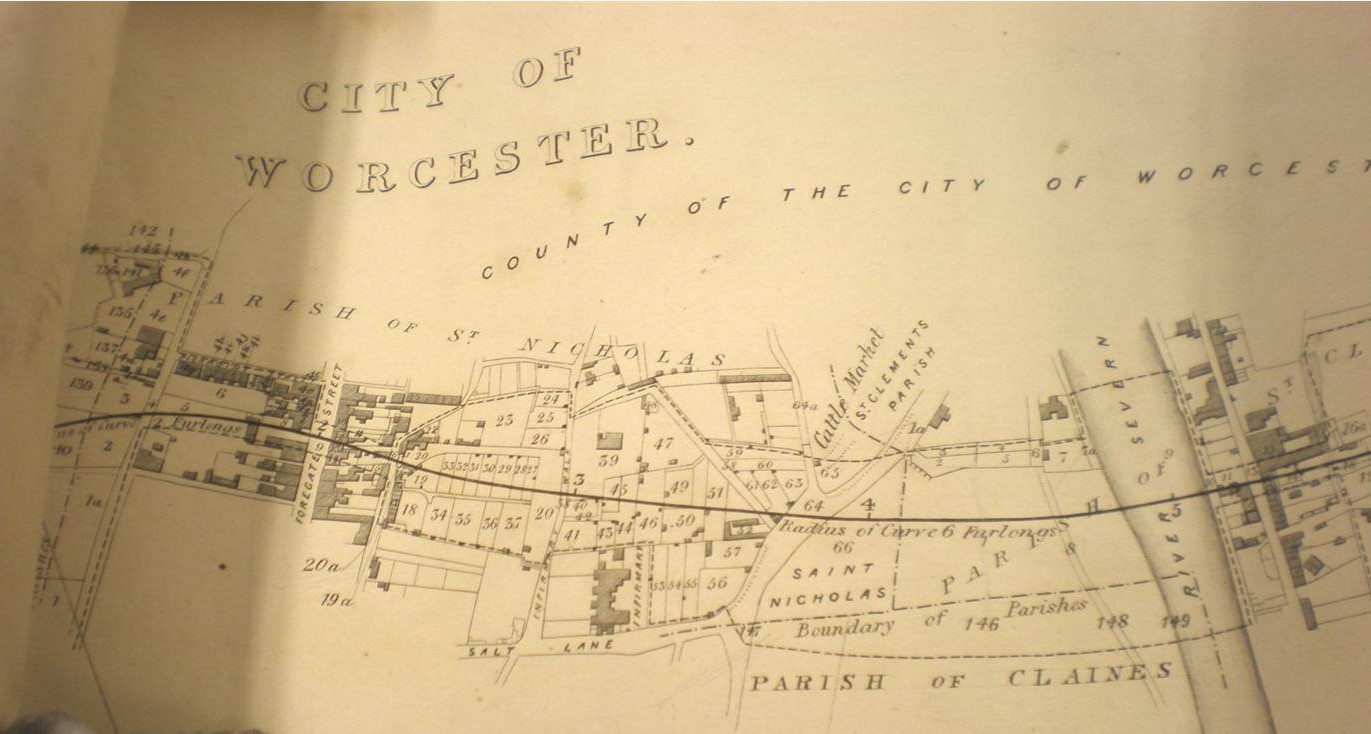
Map which was part of the application for the railway, showing the proposed route.
The viaduct was built in late 1850s, being completed in 1859, as part of the Worcester to Hereford Railway which linked the city to Herefordshire and Wales.
Railways had already arrived in Worcester in 1850, when Shrub Hill Station opened, following the Railway Mania of the 1840s when the railway network grew rapidly across the country. Worcester was now linked to London and much of England through this line.
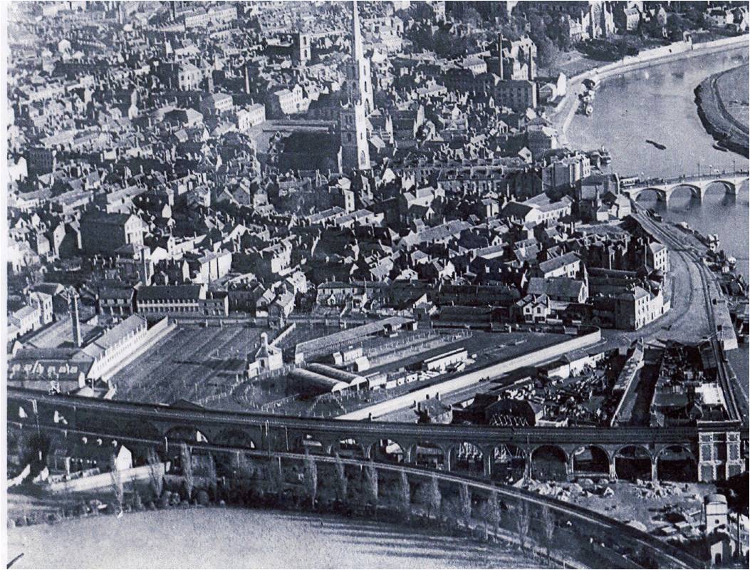
Aerial photo showing the Viaduct, with the Cattle Market, All Saints, St Andrew’s and other Worcester landmarks. The North Quay siding can be seen at the bottom. Aerofilms c1920 (c) Historic England
Shortly after this a proposal was made to build a line to link Worcester to Malvern, Hereford and South Wales. This was supported by Worcester City Corporation who could see the benefits of opening up transport to the west. Parliament was approached, because an Act of Parliament was needed for each new line, and this was approved, although there was a delay because they said the line had to be independent, and other railway companies couldn’t invest in it. This was relaxed after a few years, and work began on the line, although the route outside of the Worcester was amended.
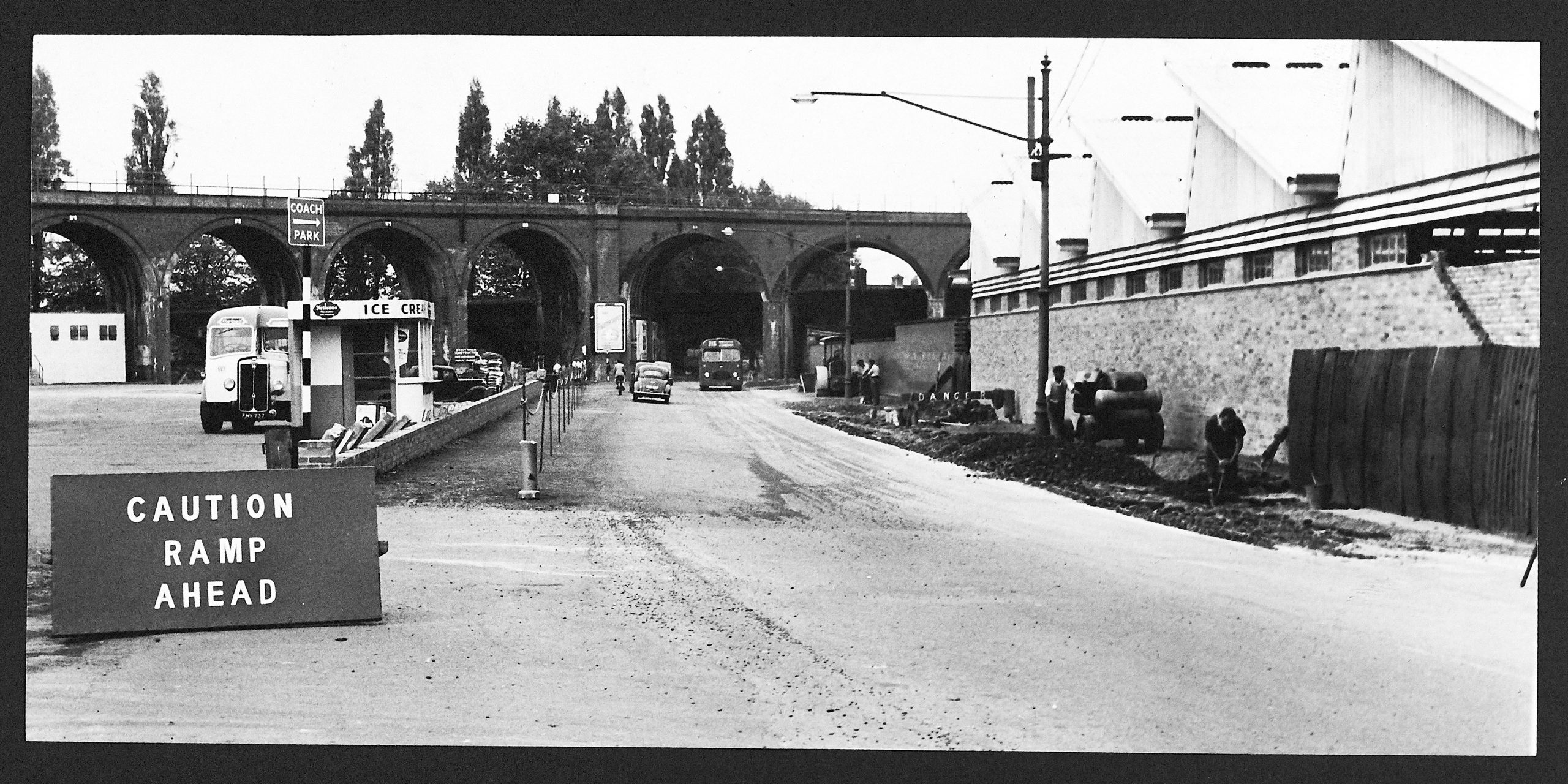
Raising of Croft Road surface level in 1959, showing the Arches in the background. (c) Worcester News
Like many other railways lines there were various engineering challenges due to the geography. A tunnel had to be built through the hard rock of the Malvern Hills, with a 31 viaduct needed at in Ledbury as well as Worcester’s. For these reasons the line opened in stages, starting with Henwick to Malvern. The viaduct was finished in 1859, but there was a delay in being able to travel the whole route in one go because the bridge across the Severn wasn’t passed as safe for trains to use until. The safety inspector, Colonel Yolland, noticed that the bridge swayed when trains crossed, so required it to be strengthened. This meant passengers had to disembark and walk across the bridge to Henwick station on the far side, before continuing! The original bridge was a three arch structure, which was replaced by the current girder bridge in 1905.
If you look at the viaduct today you may notice that there is a section which appears to be coming down lower than the main bridge. People sometimes ask what this is. This is the Butts Branch Railway, which opened 1859. Instead of crossing the river it descended to North Quay and went along the riverside to support the trade and warehouses. It was supposed to go down to Diglis but the Cathedral authorities opposed this. The North Quay line closed in the 1930s, although it continued to serve the racecourse until the 1950s, transporting racehorses. Parts were demolished in the 1960s.
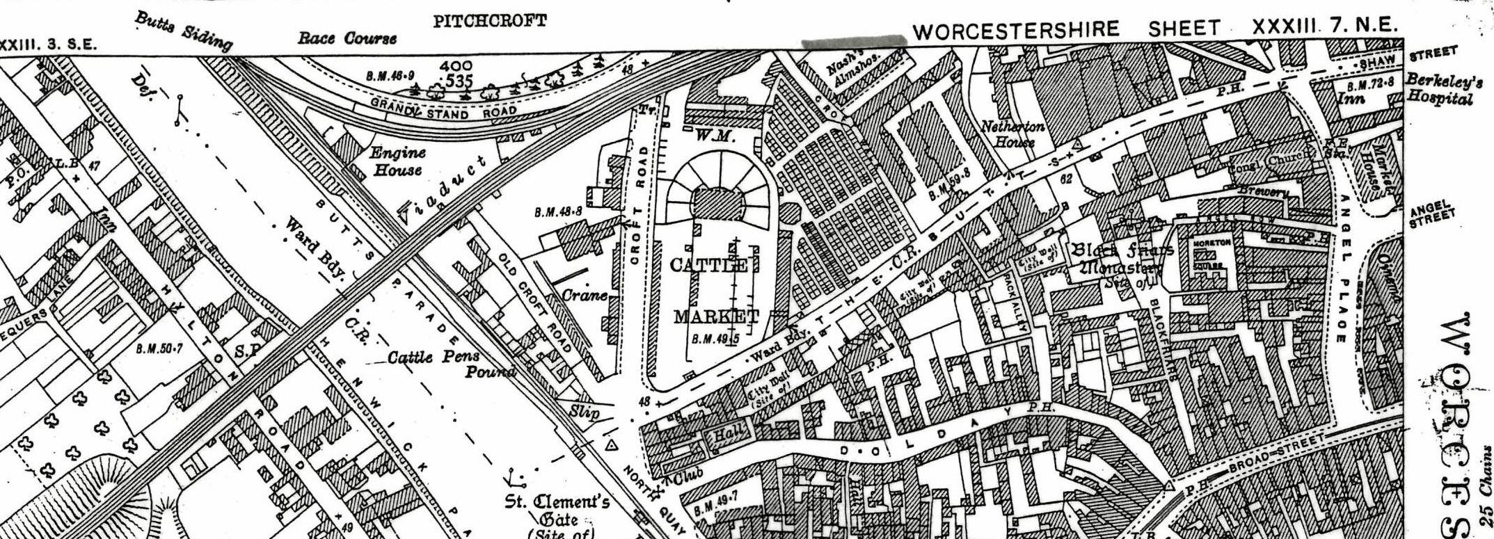
1928 Ordnance survey map showing the Butts siding leaving the Viaduct
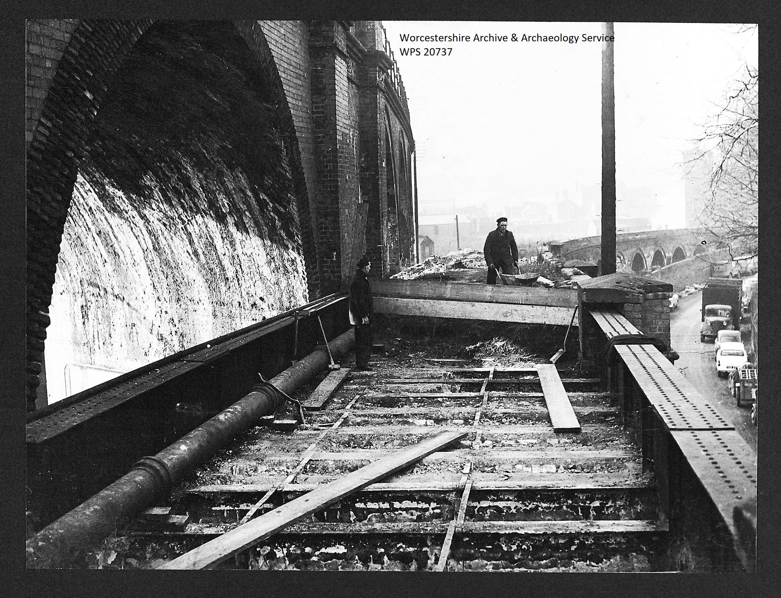
Demolishing part of the railways which went down to North Quay in 1960. (c) Worcester News
The line had benefits for both businesses and passengers. The lined opened up a route to the south and west, and enabled people to visit Malvern, making a big difference to tourism. Malvern’s population was just 4,000, but 5,000 day visitors arrived in 1861. Many Worcester companies used the canals, but they started to use railways more and more. The Vinegar works, the largest in the world, even had their own siding. The new line allowed goods to be transported quicker and more efficiently between Worcester and South Wales, and town in between.
The viaduct was built through an area that was becoming built up. From Roman times, when the land was part of a busy area, to the 18th century, it was outside the city walls, and had been undeveloped. In the 18th century gardens occupied the site and was part of the Netherton Estate, including Netherton House, which became a private school. With the planned railway coming through the site the Netherton Estate was sold off. On one side of the site was Worcester Royal Infirmary, and on the other a timber yard owned by Joseph Wood, whose company still operates today in Worcester, and the Cattle Market. Some houses were by the line, and twins Elsie and Josie, who grew up here in the 1920s, recall waving to the train drivers as they passed, being so close that they could shout over.
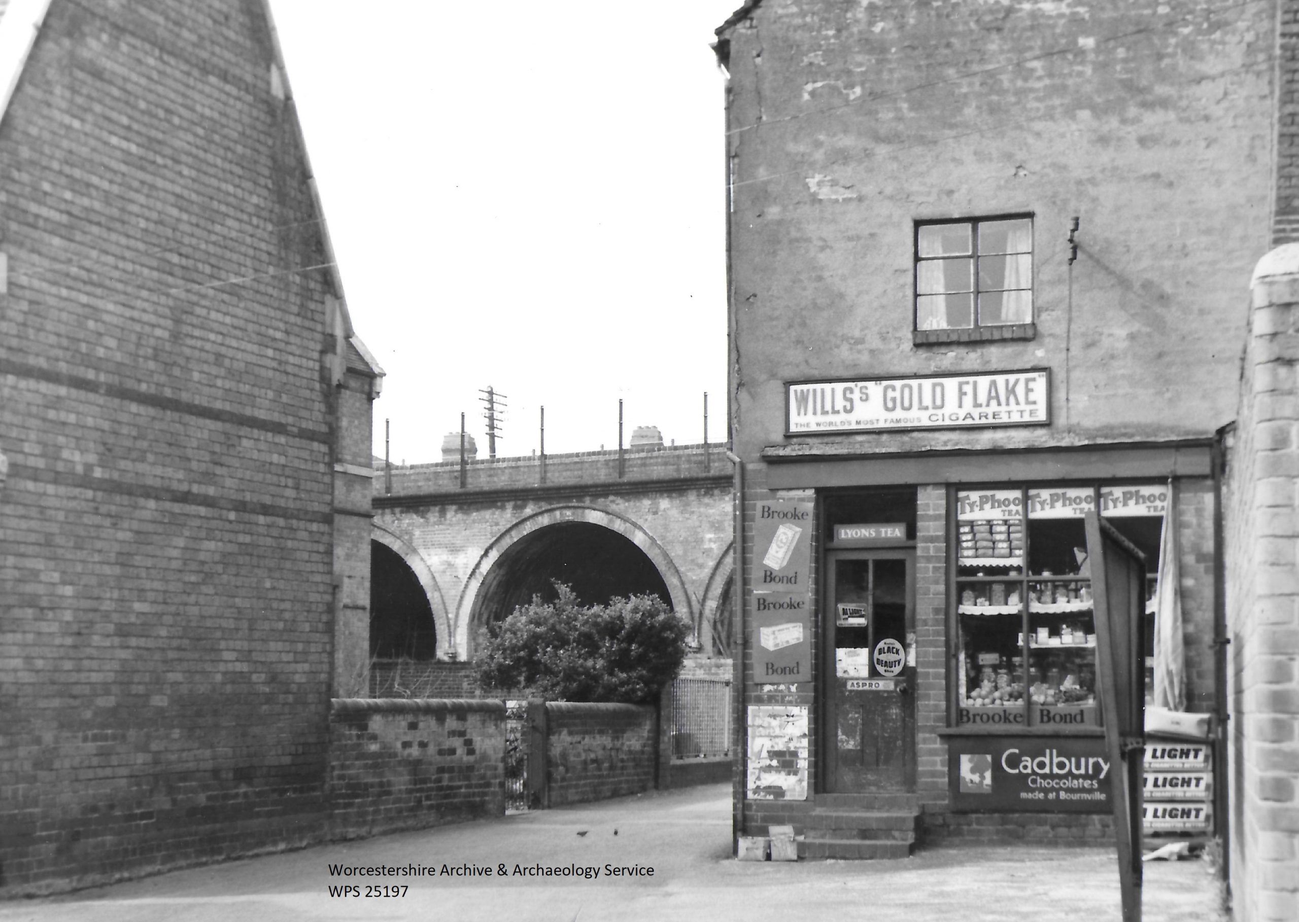
Infirmary Walk, 1962. H.D.Small
A shorter version of this article was published in the Worcester News in 2021
Twins Elise and Josie grew up in Netherton Lane before WWII, just by the viaduct. They recalled the neighbourhood, including the arches, which were then used by courting couples!
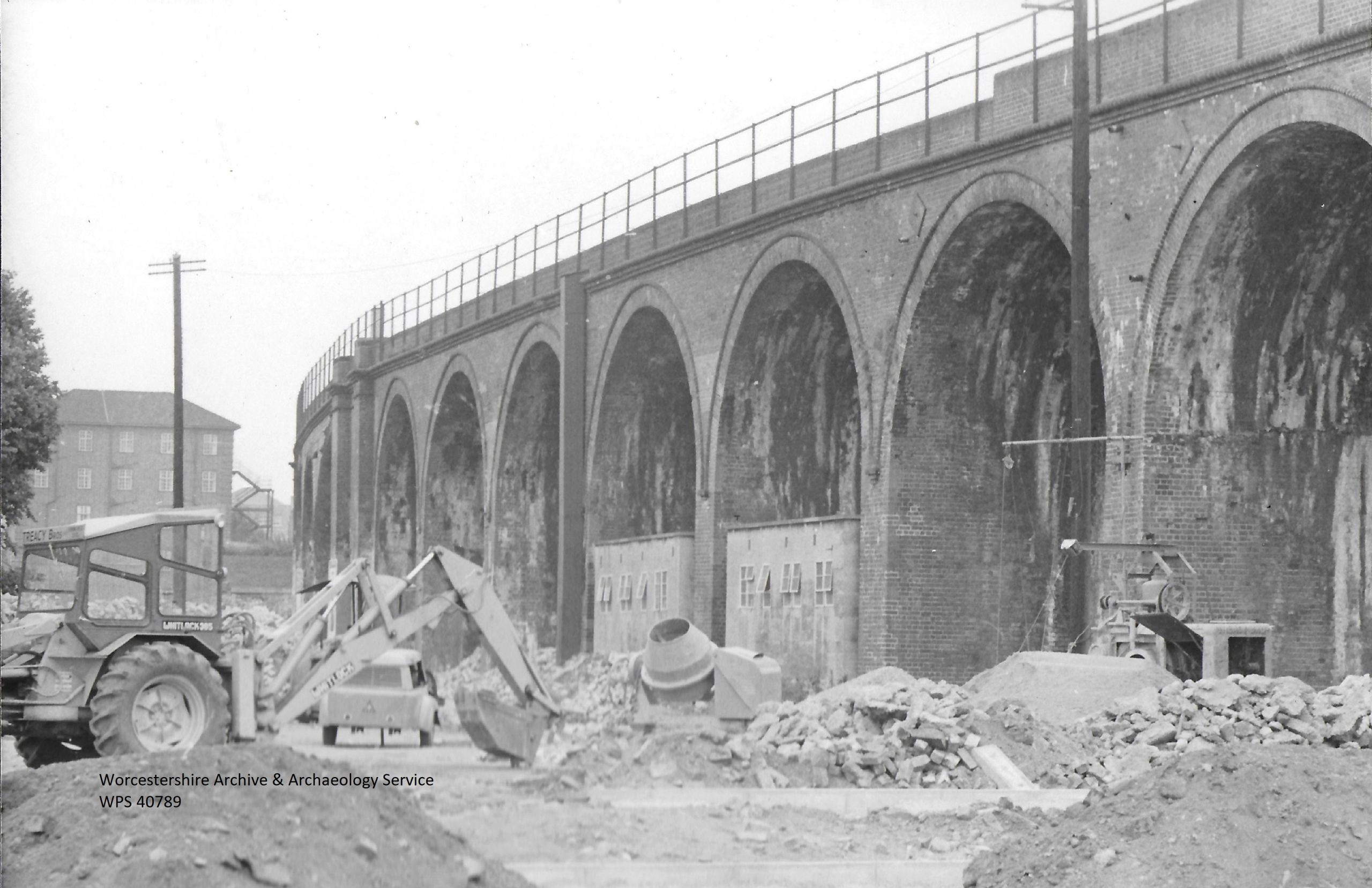
Viaduct 1968
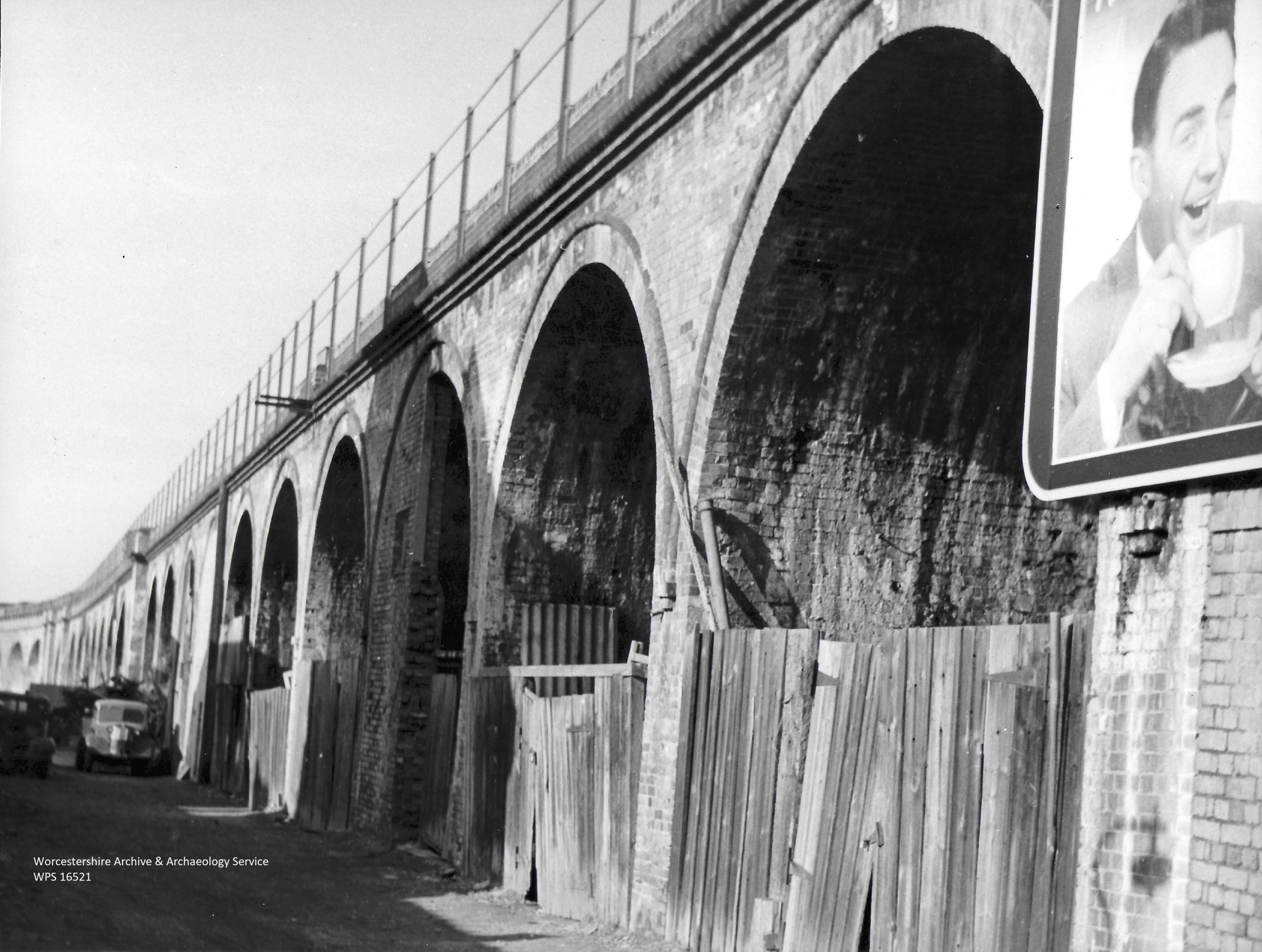
Railway Viaduct 1959
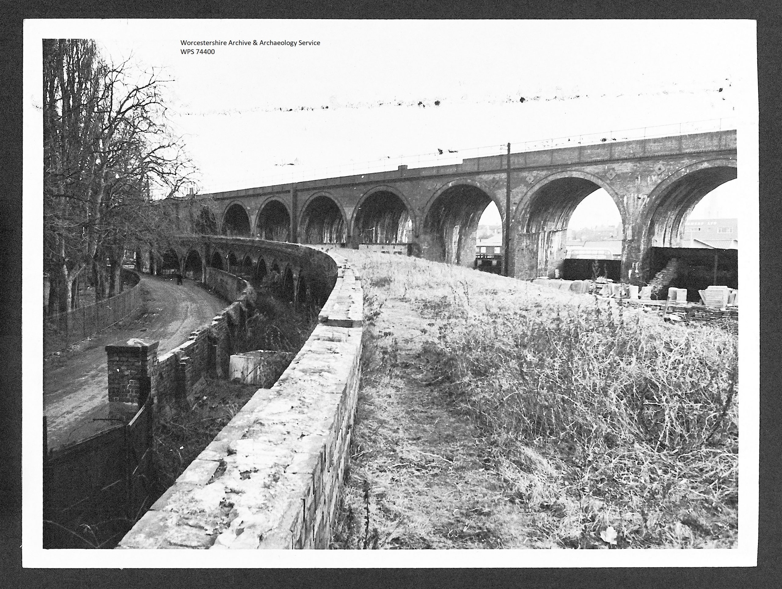
Viaduct 1966
Post a Comment