Redditch New Town and New Jerusalems
- 23rd November 2022
In April 1964, Redditch was designated a New Town, to relieve post-war overcrowding in Birmingham. Here at Worcestershire Archives & Archaeology Service we have several deposits of records from Redditch Development Corporation, the authority with oversight for Redditch re-development. We also have deposits from Commission for New Towns (later English Partnerships), the body that inherited the work of Development Corporations, managing commercial and industrial assets after the initial stages.
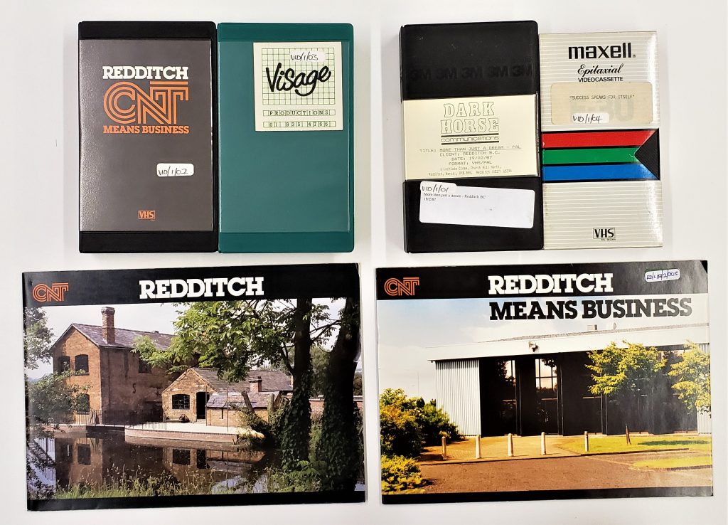
BA14226. Redditch Development Corporation Library Promotional videos 1986-7 and brochures c.1980
The Wellcome Trust have awarded a Research Resources Award in Humanities and Social Science grant of £427,809 to a network of archive services. This will secure the future of eleven New Town collections. As part of this, Redditch New Town records will be surveyed and arranged, keeping the original order of its administrative use intact. Catalogues will be added to the online database on our Explore The Past website. Retro-conversion of existing catalogues will also be added. Records will be re-packaged and have conservation treatment where required. This will ensure the material is more easily accessible to the public for research purposes from local and family historians to students and academics. It will be a fundamental change in the evidence base currently available for research into the New Town movement and will support revived interest in the impact of housing and urban design on public health in our post Covid era.
We have enlisted in-house Archivists Alice, Vicky, and Zoe for the task, with help from our Archivist-in-Training Tom and oversight of Senior Archivists. Local volunteers of Redditch will provide significant assistance with their keen awareness of the town’s older history and celebration of its New Town status.
The Redditch New Town collection covers a diverse range of material such as:
Town Centre Survey 1968: records dividing the town into 24 blocks including maps, lists of properties, press cuttings, correspondence, information regarding compulsory purchase orders and questionnaires.
Site investigations 1960s-1980s: covering the whole designated area of land, including soil investigation reports, drainage surveys, and trial pit investigations.
***As an aside, our team have joked about Alice’s newly gained knowledge of soil tests as a result of this project, so do quiz her about ‘triaxial compression tests’ or ‘particle size distribution curves’ if you see her. Only joking of course!***
Registers of Seals and details of public enquiries 1964-1992: plans, photos, and correspondence. Also, promotional material including videos and employment surveys.
Records of tenants of estates; copy accounts, tax files and other papers 1970s-80s: with various working papers on Industrial Building Allowances, including records of tenants.
Of course, not all these records are currently open to the public for data protection reasons, but it is possible that special permission may be granted, if sought.
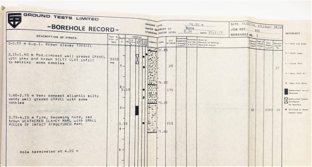
BA13606 Site Investigation Report for Holloway Drive E District Distributor, Extract of Borehole Record no.3. 20 Feb 1972
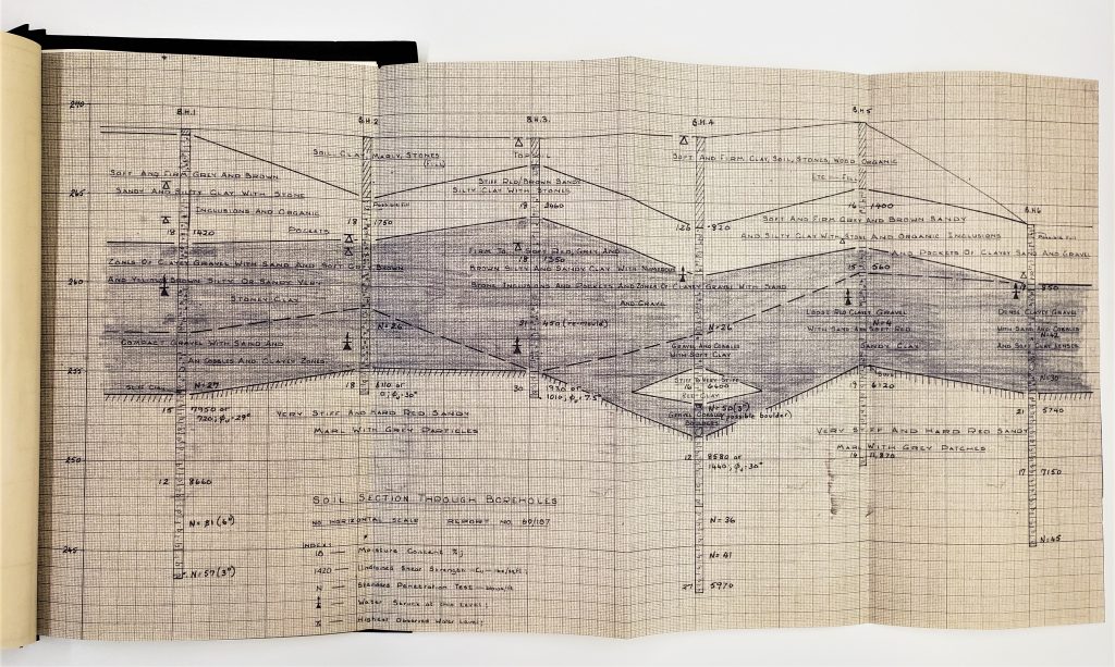
BA13606 Report of Soil Investigation at Site of Proposed Brook Street Factories in the Studley Road Area (North). Soil Section Through Boreholes. Nov 1969
The population target was 70,000 over 15 years, allowing for 29,000 already in situ and 33,000 moving into the area. This was expected to increase to 90,000 by the end of the century. The re-development allowed for not just housing, but other needs of the people who lived and worked there, such as industry, health services, education, transport, water and sewerage services. With a vision to echo modernist European-style estates and borrowing garden city ideals such as nearby Bournville, there was a desire to bring together town and country to improve the lives of those who lived and worked there. In fact Master Planner and Board Member Hugh Wilson was chosen for his desire to enhance the development through landscaping. In fact, the design features of many British New Towns turn into one of our biggest ‘exports’ with planners and engineers from abroad travelling to here to learn from them.
As locals will know, the town boundary is on the site of a Roman camp. Some 600 or more years later, King John b.1166 – d.1216, buried at Worcester Cathedral, built a Royal hunting lodge in Forrest of Feckenham, and on the outskirts previously in 1148AD Cistercian Monks built Bordesley Abbey on the little Arrow Brook known as the ‘Red Ditch’. A few houses were built around the monastery, and it became a hamlet known as La Rededich. Don’t forget this was little over a century after 1066, a time when England was ruled by Norman-French, who replaced much of English aristocracy and senior clergy. The monks at Bordesley grew crops and fruit but also became skilled in forging metal products, anticipating Redditch’s industrial heritage in metal-based trades such as needle industry, fishing tackle, bicycle parts and vehicles to name a few examples. For more information and access to the archaeological site visit Bordesley Abbey | Forge Mill Needle Museum / www.forgemill.org.uk
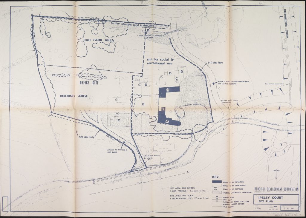
BA14226 Land at Ipsley Court Public Inquiry. Site plan. 19 Jan 1971
Plans went ahead but not without confrontation and an initial Public Inquiry looking into building on the green belt, a high population target, heavily slashed transport links and already overburdened health services. Sound familiar?
So many factors were involved in the Master Plan and these were researched in-depth beforehand. The Report of Redditch New Town Planning Proposals, December 1966 (BA14266) provides clear insight into its concept and principles with considerations that would: allow for flexible use of land; fast moving traffic-not interfering with safe routes for pedestrians; a defined boundary between urban and countryside; a population that was mixed in terms of ages, family structure and employment; and a town that was future proof. Phew! The report goes into detail in the following aspects of plan:
-Housing Industry
-Central Area
-Community facilities
-Communications
-Landscape
-Utilities
-Summary of Land Use
-Programme
-Town Character
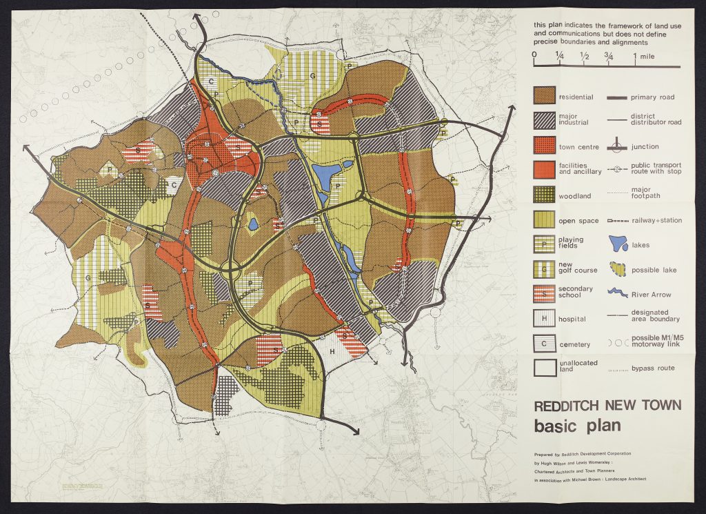
BA14226 Redditch New Town Master Plan. Prepared for Redditch Development Corporation. 1966
A Breakdown of Land Use in the Master Plan:
Housing 1,200 acres
Education 250 acres
Central area 150 acres
Industry 675 acres
Open Space (excluding golf courses) 750 acres
Despite a wealth of research and careful planning, the large-scale re-development proved an upheaval for some locals. As mentioned above, Redditch, with its wealth of history was already an established town with far more public facilities and significant sites than other Development Corporations had to re-define. It is perhaps no surprise that Public Inquiries continued throughout the development. So far, our initial survey of records has identified several such as Ipsley Court, Arrow Valley Park, and several compulsory purchase orders including Spernall proposed sewage works – which astonishingly even fell outside the 7,200 acres of land in the designated area.
This project is set to provide better access to a wealth of research material concerning urban design and public health. We can’t wait to collaborate with other archive services on this project. We will be keeping you up to date over the two-year project which will culminate in an exhibition at The Hive and local events in Redditch.
Follow us on Twitter at @ExploreThePast or Facebook @WorcsAAS
An interesting collection and well worth archiving.