A focus on photogrammetry: Hartlebury Castle
- 31st January 2023
Gathering data for archaeological purposes has traditionally involved string lines, measuring tapes and pencils. This blog explores a digital technique that is now widely used within archaeological practice: photogrammetry. To best illustrate its uses, we will focus on Hartlebury Castle as a case study.
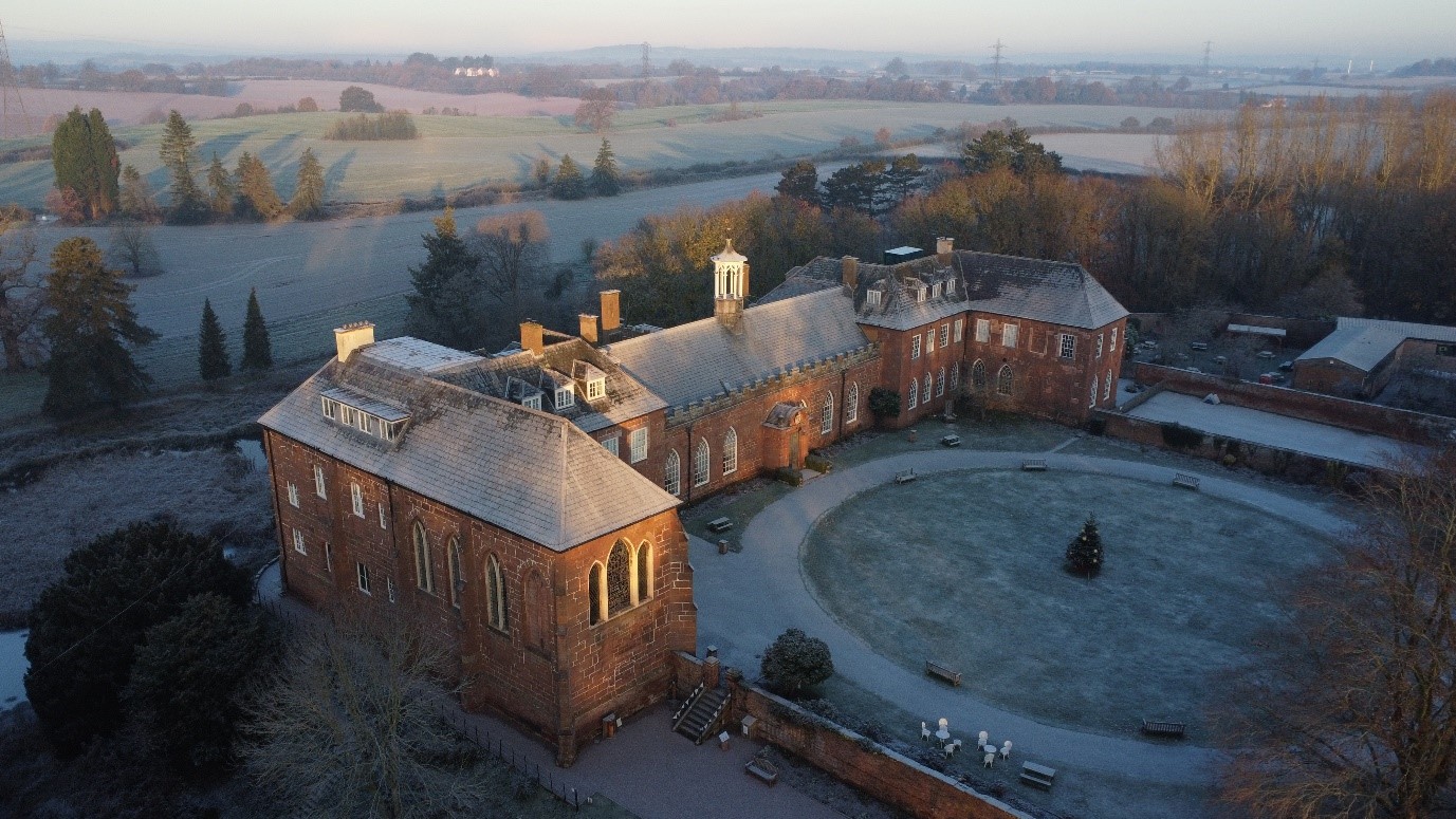
Hartlebury Castle looking north-west
Photogrammetry: what, how and when?
So first, what is photogrammetry? It has been defined as “the art, science and technology of obtaining reliable information about physical objects and the environment, through the process of recording, measuring and interpreting imagery” (ASPRS 2023). At its core, photogrammetry is very simple. It is based upon simple lines of site and vanishing points, which will be familiar to those interested in art; these techniques were first clearly expressed by Renaissance artists to create true perspective images. The photogrammetry process flips this on its head by taking imaging and recreating the relative geometry between multiple images of the same subject. With three or more images, it is possible to recreate a point in three-dimensional space using line of sight triangulation.
Before we lose you in science and principle, it’s worth delving into a little history of the technique, as it’s much older than you might expect. The potential for photographs to recreate real world geometry was realised at the dawn of photography itself. Following on from photography becoming widely available for the first time in the 1830s (with the Daguerreotype process), it didn’t take long until a plan of Paris was being attempted by surveyor Aimé Laussedat in the 1840s. He mounted a camera on to a surveyor’s plane table and use the photographs taken to manually plot a map of Paris, which no doubt took a considerable time.
With the arrival of aviation in the early 20th century, cameras were attached to planes and wider landscape mapping using photogrammetric techniques increasing took place, with analogue plotters developed to speed up the process.
The next shift change in photogrammetry came with computing, from the later 20th century onwards. Computers enabled photogrammetry to go from a relatively simple (if time consuming) mapping technique to extremely complex 3D modelling. Increasingly large data sets could be interrogated by increasingly complex algorithms, which assessed the data through pattern recognition, distortion corrections and more, before even starting to build the model. Along with these, a myriad of developments – including Global Positioning Systems (GPS), drone technology and photogrammetry software – have become extremely powerful tools for archaeologists.
Photogrammetry in archaeology
So, what are its uses to archaeologists and the wider public? Photogrammetry’s first and most visually impressive use is for 3D modelling. To give an example, let’s take a look at our case study, which was undertaken with the kind permission of Hartlebury Castle. We created 3D modelling of the building by careful drone flight, capturing over a thousand images from all available angles. These were then processed using photogrammetry software, which in turn produced millions of points that accurately represent the structure’s geometry. These points are then linked by millions of accurately colourised triangle meshes, creating the model’s continuous surface.
For archaeologists, the most useful element of this technology is the ability choose a single plane of the model and produce a dimensionally accurate photo quality image, such as those below. The obvious use for these images is in creating precise building elevations, but with significantly more detail than hand-drawn plans (and no need for ladders!).
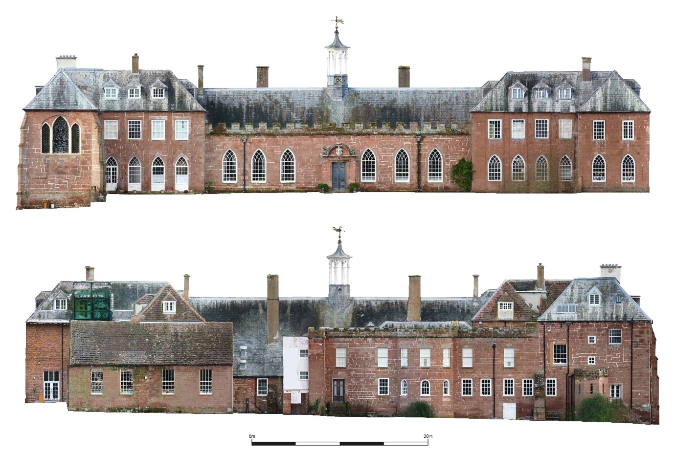
Photogrammetrically produced elevations of Hartlebury Castle, east facing elevation at the top, west facing below
A word of warning should perhaps be inserted here, in that this technique is, in the end, just a tool. The benefit of a hand drawn elevation is not only that hand drawing requires close observation of details, but also allows for interpretation throughout the process. Photogrammetry cannot phase a building: that remains the preserve of the human.
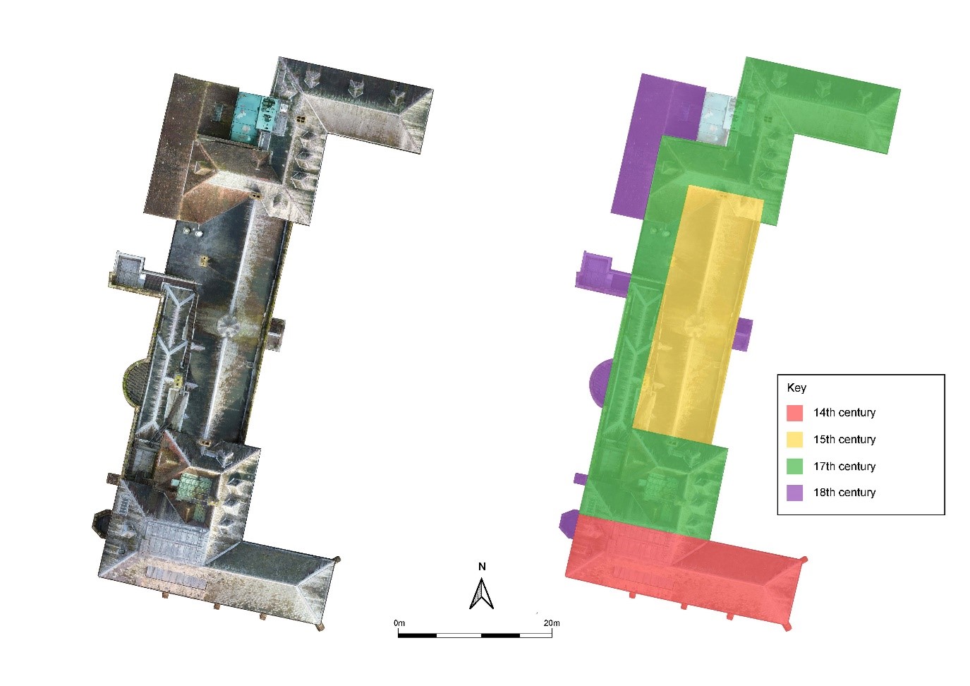
Photogrammetrically produced roof plan with phasing interpretation of Hartlebury Castle
To give an example, the roof plan above offers greater visibility of the structure, but software alone cannot compare this image against pre-existing phase plans of this complex medieval building (Molyneux 2010). Added to this is the fact that each elevation shows numerous changes and additions, meaning that no one view of such a complex building can tell the whole story of change. Picking out the story of the structure remains down to you – the intelligent human observer.
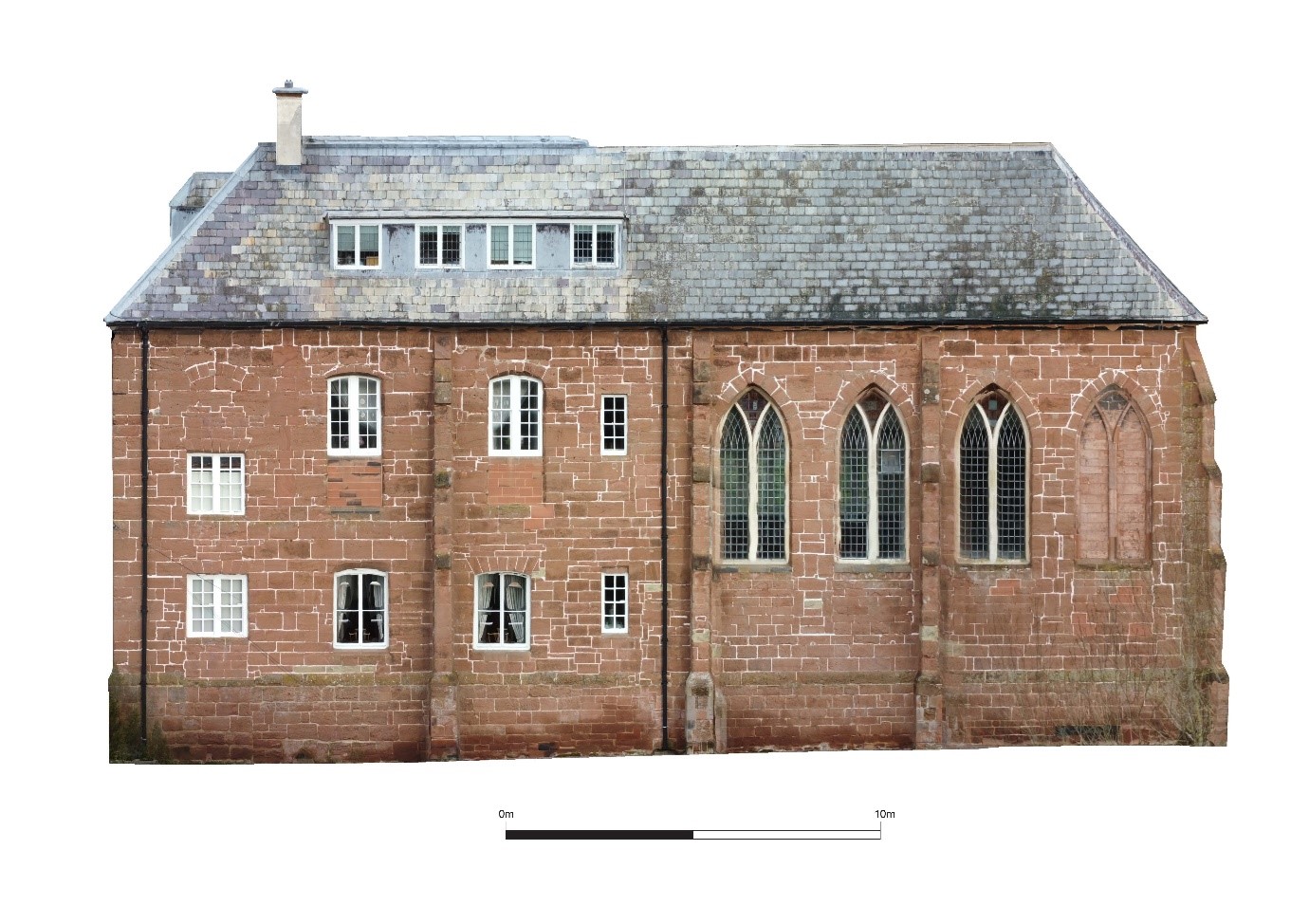
Spot the signs of change on this photogrammetrically produced elevation of Hartlebury Castle chapel (south facing)
Acknowledgements
Our thanks go to Hartlebury Castle Preservation Trust for allowing access to the building for the purposes of detailed modelling, production of plans, elevations and this blog.
References
ASPRS 2023 American Society for Photogrammetry and Remote Sensing website, Accessed 19th January 2023
Molyneux, N 2010 Hartlebury Castle, Worcestershire: an architectural history of a bishop’s residence, Transactions of the Worcestershire Archaeology Society 2010, Series 3 Volume 22, pages 129-165
Part 2: Read about a possible Civil War bastion that’s remained undetected for centuries in Cropmarks, photogrammetry & the Civil War at Hartlebury Castle

Post a Comment